Food - Colombia’s most common dishes - Chuleta Valluna dish, which is very popular in restaurants12/19/2016  Visiting Colombia means that there are different things you have to try out in order to have value for your money and precious time. With each region having their own representative dishes, I would recommend the diverse and sumptuous cuisines the friendly citizens have incorporated into their menu. The versatility of Colombian food makes it rich, flavorful, vibrant and soothing. The people have upheld their superb ancestral dishes through many generations, swayed by not only indigenous Colombian culture, but also Spanish, African as well as Arab cultures. The Arepas is one of Colombia’s most common dishes, which is served in practically every household. There are varieties of arepas in every region, which makes them suitable for every meal of the day. They act as appetizers, snacks or garnishes but can also definitely make a full and nourishing meal and can be prepared with varieties of fillings or toppings. Another delicacy is Tamales, which is characterized by wrapping of banana leaves. The filling contains carrots, rice, chicken, masa, peas, pork belly and ribs, boiled egg, potatoes and condiments. It is mostly prevalent in Tolima region and can be accompanied by hot chocolate and arepa. 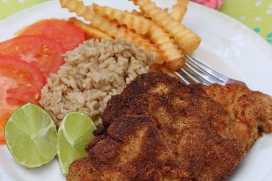 Try out Chuleta Valluna dish, which is very popular in restaurants and normally served with potatoes, rice, beans, salad, or yucca. This Pork delicacy originated from El Valle region.
0 Comments
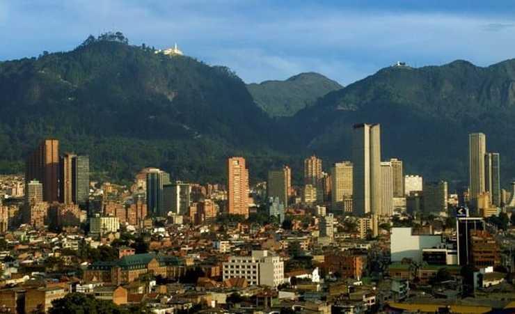 Colombia is a country with ancient historical tourist attraction sites. The South American Country offers extraordinary scenery with cinematic paved towns and villages that makes a visitor feel like he has been tossed into an ancient century. The Spanish-speaking country is just breaking its shells to blossom into the modern world stage, as it is thoroughly marred by is past. Colombia is renowned for its coffee estates, and even the adorable culture leaves travelers with the urge to revisit. Colombia’s equatorial location provides it with a diversity of landscapes matched by a few countries. 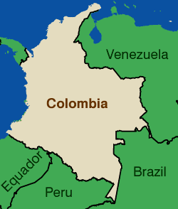 The culture of Colombia Colombia’s assorted cultural heritage originates from the co-occurrence of the Spanish explorers, the native Indians as well as African slaves. Several towns have a major influence on its Spanish culture. An affluence of ancient cultures left behind a charming expanse of cultural and archaeological sites all over Colombia. One of the most pleasant-sounding symbolic expressions of the country is Cumbia and Vallenato music. Cumbia combines three cultures: African, European and Indigenous. The African effect provides the beat of the drums, the Indigenous-centered flute fuses with the tune and the European offers some distinctions in the songs, dance routines and dancers’ costumes. 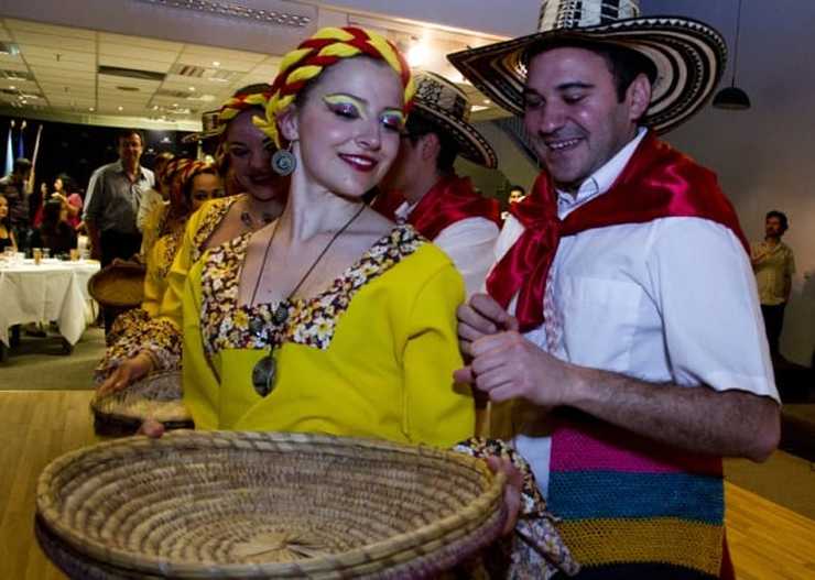 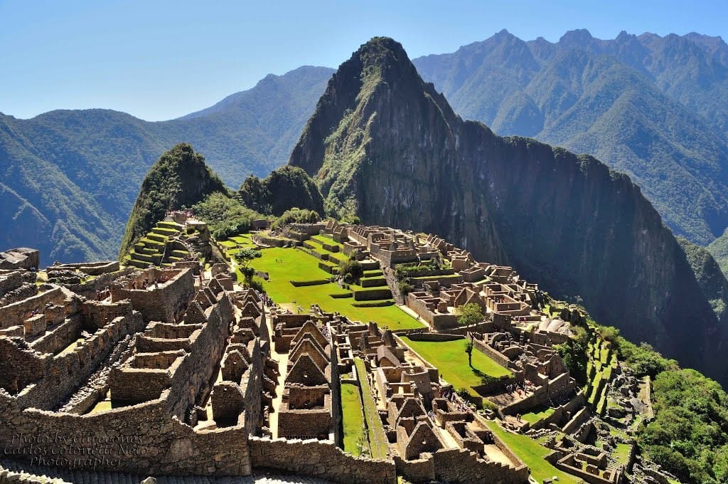 Peru is an amazing country in every aspect. A country with history of more than 5000 years and a destination that embraces countless tourist destinations. Peru has attractions and notable places for travelers to enjoy during their vacation. This history-rich country provides you with the chance to encounter incredible cultures, captivating festivals and natural sceneries where you can pass pleasant time just relaxing. The culture of Peru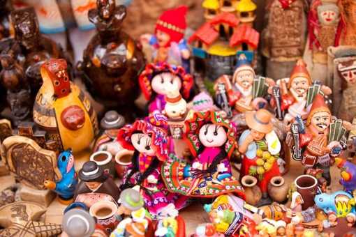 The pronounced culture of ancient Peru articulates a heritage and diversity of native tongues that co-exist in its land. Spanish is the official language but other constitutionally recognized languages are Quechua and Aimara. Peru claims one of the leading assortments of arts and crafts in the world, as can be grasped from the increasing network of exporters who unveil the dexterity of Peruvian artisans in Europe, North America and Asia. The color, diversity, originality and several purposes of Peru's traditional art makes it a central activity for both its cultural uniqueness, and a lifestyle for thousands of people and entire populations, for example Quinua and Sarhua in Ayacucho. With outstanding cuisine and gastronomy, diverse and bursting with colors and aromas, its partition into coast, moorlands and jungle, Peru offers a cultural multiplicity that makes it a nation full of distinctions and charms, always unforeseen and fascinating.
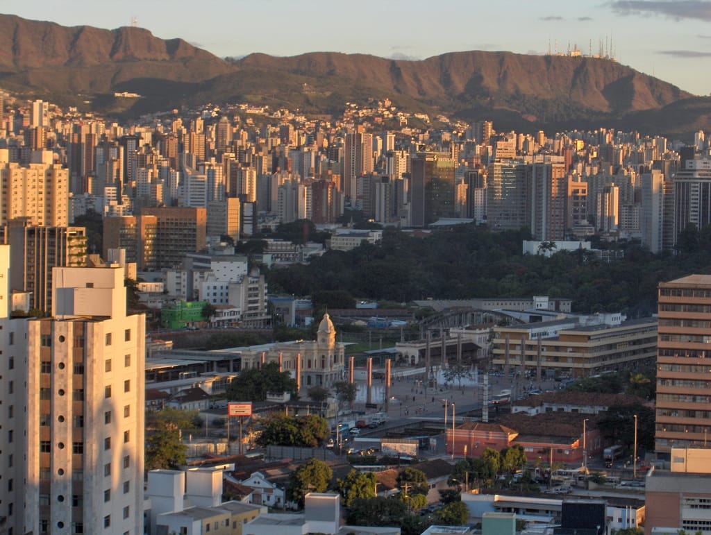 Belo Horizonte is the sixth largest city in Brazil, the thirteenth largest city in South America and the eighteenth largest city in the Americas. The metropolis is anchor to the Belo Horizonte metropolitan area, ranked as the third most populous metropolitan area in Brazil and the seventeenth most populous in the Americas. Belo Horizonte is the capital of the state of Minas Gerais, Brazil's second most populous state. It is the first planned modern city in Brazil. History of Belo Horizonte The region was first settled in the early 18th century, but the city as it is known today was planned and constructed in the 1890s, in order to replace Ouro Preto as the capital of Minas Gerais. The city features a mixture of contemporary and classical buildings, and is home to several modern Brazilian architectural icons, most notably the Pampulha Complex. In planning the city, Aarão Reis and Francisco Bicalho sought inspiration in the urban planning of Washington, D.C.The city has employed notable programs in urban revitalization and food security, for which it has been awarded international accolades. Belo Horizonte was one of the host cities of the 1950 and the 2014 FIFA World Cup. Additionally, the city shared the host of the 2013 FIFA Confederations Cup. structure of this city Belo Horizonte , Brazil
The city is built on several hills and is completely surrounded by mountains.There are several large parks in the immediate surroundings of Belo Horizonte. The Mangabeiras Park | Parque das Mangabeiras |, located 6 km | 4 mi | south-east from the city centre in the hills of Curral Ridge | Serra do Curral |, has a very broad view of the city. It has an area of 2.35 km2 | 580 acres | , of which 0.9 km2 | 220 acres | is covered by the native forest. The Jambeiro Woods |Mata do Jambeiro| nature reserve extends over 912 hectares | 2,250 acres | with vegetation typical of the Atlantic forest. More than one hundred species of birds inhabit the reserve, as well as ten different species of mammals. 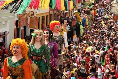 Tourism and recreation
Carnival attracts a lot of tourists.The celebrations, holidays and other events are numerous during the whole year. Thus the New Year begins at the beach, Praia de Boa Viagem and in Old Recife. The carnival of Recife and Olinda which has its historic town centre considered world heritage site by UNESCO in 1982 begins many weeks ahead in December with innumerable balls and parades. In the city, the carnival festivities begin in December, as locals begin preparing for the official Carnival, which starts the week before Ash Wednesday. The pre-Carnival parties usually consist of percussion groups practicing in local clubs, city streets and squares, and even Carnival balls. There is a variety of rhythms from different cultures. Carnival officially starts with the Galo da Madrugada, a party in Downtown Recife attracting many people from several States of Brazil, and other parts of the world. Recife has many quality 3, 4 and 5-Star International Hotels as well Pousadas | traditional Bed & breakfast| and Apart-Hotels totaling more than 11,500 bedrooms and this number increase to over 30,000 in the metropolitan area of Recife. 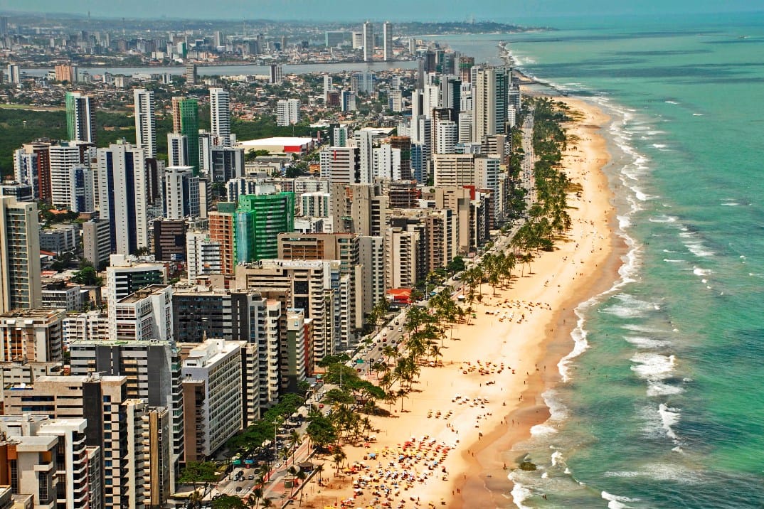 Recife is the sixth-largest metropolitan area in Brazil with 3,743,854 inhabitants, the largest metropolitan area of the North | Northeast Regions, the sixth largest metropolitan influence area in Brazil, and the capital and largest city of the state of Pernambuco. History of this city The former capital of the 17th century Dutch Brazil, Recife was founded in 1537, during the early Portuguese colonization of Brazil, as the main harbor of the Captaincy of Pernambuco, known for its large scale production of sugar cane. The city is located at the confluence of the Beberibe and Capibaribe rivers before they flow into the Atlantic Ocean. It is a major port on the Atlantic Ocean. Its name is an allusion to the stone reefs that are present by the city's shores. The many rivers, small islands and over 50 bridges found in Recife city centre characterise its geography and led to the city being called the "Brazilian Venice". As of 2010, it is the capital city with the highest HDI in Northeast Brazil and second highest HDI in the entire North and Northeast Brazil . 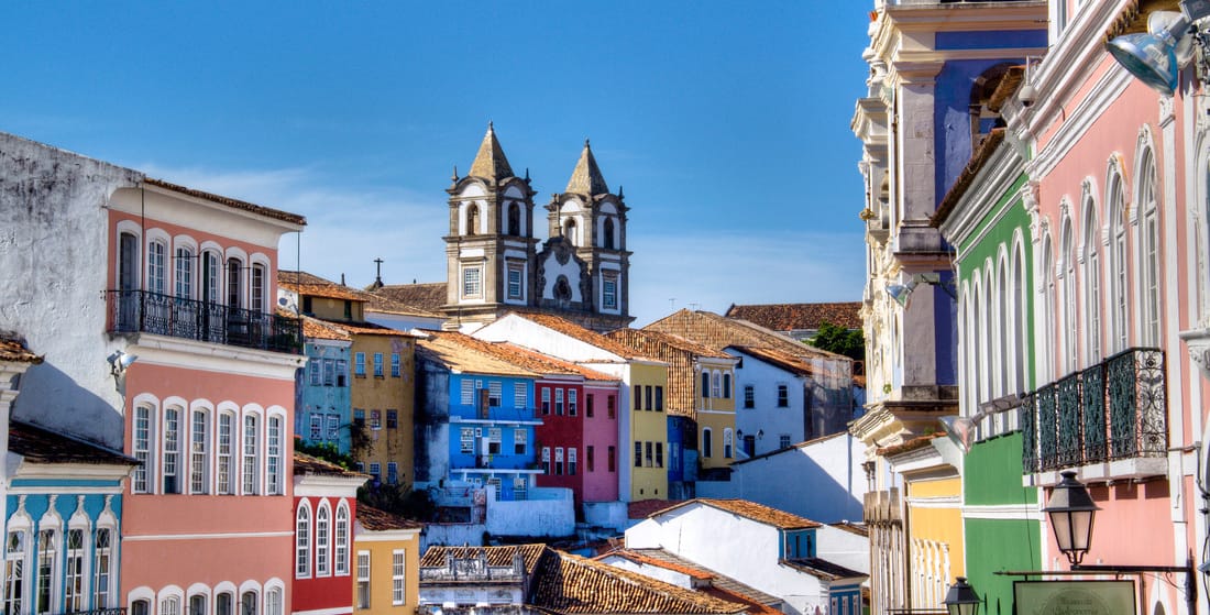 Recife stands out as a major tourist attraction of the Northeast, both for its beaches and for its historic sites, dating back to both the Portuguese and the Dutch colonization of the region. The beach of Porto de Galinhas, 60 kilometers 37 mi south of the city, has been repeatedly awarded the title of best beach in Brazil and has drawn many tourists. The Historic Centre of Olinda, 7 kilometers 4.3 mi north of the city, was declared a UNESCO World Heritage site in 1982, and both cities' Brazilian Carnival are among the world's most famous. The Metropolitan Region of Recife is the main industrial zone of the State of Pernambuco; major products are those derived from cane | sugar and ethanol|, ships, oil platforms, electronics, software, and others. With fiscal incentives by the government, many industrial companies were started in the 1970s and 1980s. Recife has a tradition of being the most important commercial hub of the North| Northeastern region of Brazil, with more than 52,500 business enterprises in Recife plus 32,500 in the Metro Area, totaling more than 85,000. 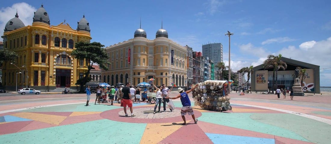 The city was one of the host cities of the 2014 FIFA World Cup. Additionally, Recife hosted the 2013 FIFA Confederations Cup and the 1950 FIFA World Cup.
The city is an education hub, and home to the Federal University of Pernambuco, the largest university in Pernambuco. Several Brazilian historical figures, such as the poet and abolitionist Castro Alves, moved to Recife for their studies. Recife and Natal are the only Brazilian cities with direct flights to the islands of Fernando de Noronha, a World Heritage Site. 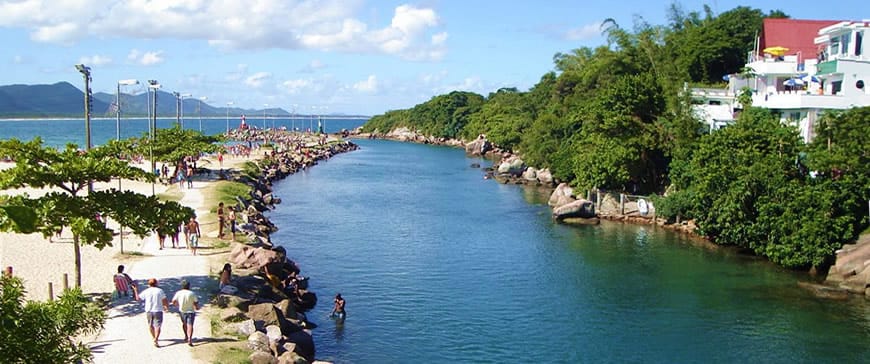 is a quaint fisherman's village but the physical characteristics of the beach make it the perfect place to learn to surf. It is a cove on the Eastern part of the island and stretches into Moçambique beach for 15 kilometres 9.3 mi. It is in a natural setting as there are no huge hotels on the beach and the Southern headquarters of Projeto TAMAR |Save the Turtles| is located here. Penguins swim into the canal and near the beach of Barra da Lagoa during the colder winter months of June, July and August. The canal at Barra da Lagoa connects the Lagoa da Conceição with the open sea. It is not uncommon to see fishermen during the night tossing their nets in the lagoa to catch shrimp they sell to the fresh fish restaurants in this community. Projeto TAMAR - Save the Turtles - facts about brazil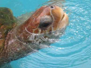 Projeto TAMAR The Projeto TAMAR | Portuguese for TAMAR Project, with TAMAR being an abbreviation of Tartarugas Marinhas, the Sea Turtles | is a Brazilian non-profit organization owned by the Chico Mendes Institute for Biodiversity Conservation. The main objective of the project is to protect sea turtles from extinction in the Brazilian coastline. History of this Project The TAMAR project was officially created in 1980.The first activities were not centered on the preservation of the turtles, but on the identification of them, their spawn sites and seasons, and the main problems caused by poaching. When the first preservation actions began, TAMAR took the first Brazilian pictures of a sea turtle spawning. In 1983, the oceanographers searched for Petrobras, to ask for support on the project. The company analyzed all the actions of the project and decided to support it, by providing fuel to their jeeps. By 2008, TAMAR managed to release more than 8 million turtles in the sea. Although the initial purpose was to protect sea turtles only, the project grew and became concerned with sharks and all the sea wildlife, as they are part of the environment in which the sea turtles live. All actions by the project intend to preserve wildlife, concern people about environment, and create sustainable places for the procreation of the species protected by TAMAR.
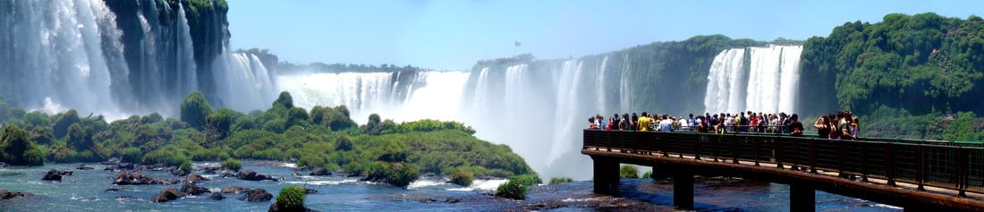 The Iguazu Falls, Iguazú Falls, Iguassu Falls, or Iguaçu Falls are waterfalls of the Iguazu River on the border of the Argentine province of Misiones and the Brazilian state of Paraná. They are the largest waterfalls system in the world. The falls divide the river into the upper and lower Iguazu. The Iguazu River rises near the city of Curitiba. For most of its course, the river flows through Brazil, however, most of the falls are on the Argentine side. Below its confluence with the San Antonio River, the Iguazu River forms the boundary between Argentina and Brazil. The name "Iguazu" comes from the Guarani or Tupi words "y" meaning "water", and "ûasú ", meaning "big".Legend has it that a deity planned to marry a beautiful woman named Naipí, who fled with her mortal lover Tarobá in a canoe. In a rage, the deity sliced the river, creating the waterfalls and condemning the lovers to an eternal fall. The first European to record the existence of the falls was the Spanish conquistador Álvar Núñez Cabeza de Vaca in 1541. 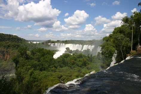 Geography The Iguazu Falls are located where the Iguazu River tumbles over the edge of the Paraná Plateau, 23 kilometres |14 mi | upriver from the Iguazu's confluence with the Paraná River. Numerous islands along the 2.7-kilometre-long | 1.7 mi |edge divide the falls into many separate waterfalls and cataracts, varying between 60 to 82 metres | 197 to 269 ft | high. The number of these smaller waterfalls fluctuates from 150 to 300, depending on the water level. Approximately half of the river's flow falls into a long and narrow chasm called the Devil's Throat .The Devil's Throat is U-shaped, 82 by 150 by 700 metres | 269 ft × 492 ft × 2,297 ft |. Placenames have been given also to many other smaller falls, such as San Martín Falls, Bossetti Falls, and many others. Distribution of the falls between Argentina and BrazilAbout 900 metres | 2,950 ft | of the 2.7-kilometre | 1.7 mi | length does not have water flowing over it. The edge of the basalt cap recedes by 3 mm | 0.1 in | per year. The water of the lower Iguazu collects in a canyon that drains into the Paraná River, a short distance downstream from the Itaipu Dam. The junction of the water flows marks the border between Brazil, Argentina, and Paraguay. There are points in the cities of Foz do Iguaçu, Brazil, Puerto Iguazú, Argentina, and Ciudad del Este, Paraguay, which have access to the Iguazu River, where the borders of all three nations may be seen, a popular tourist attraction for visitors to the three cities. The Iguazu Falls are arranged in a way that resembles a reversed letter "J". The border between Brazil and Argentina runs through the Devil's Throat. On the right bank is the Brazilian territory, which has just over 20% of the jumps of these falls, and the left side jumps are Argentine, which make up almost 80% of the falls. 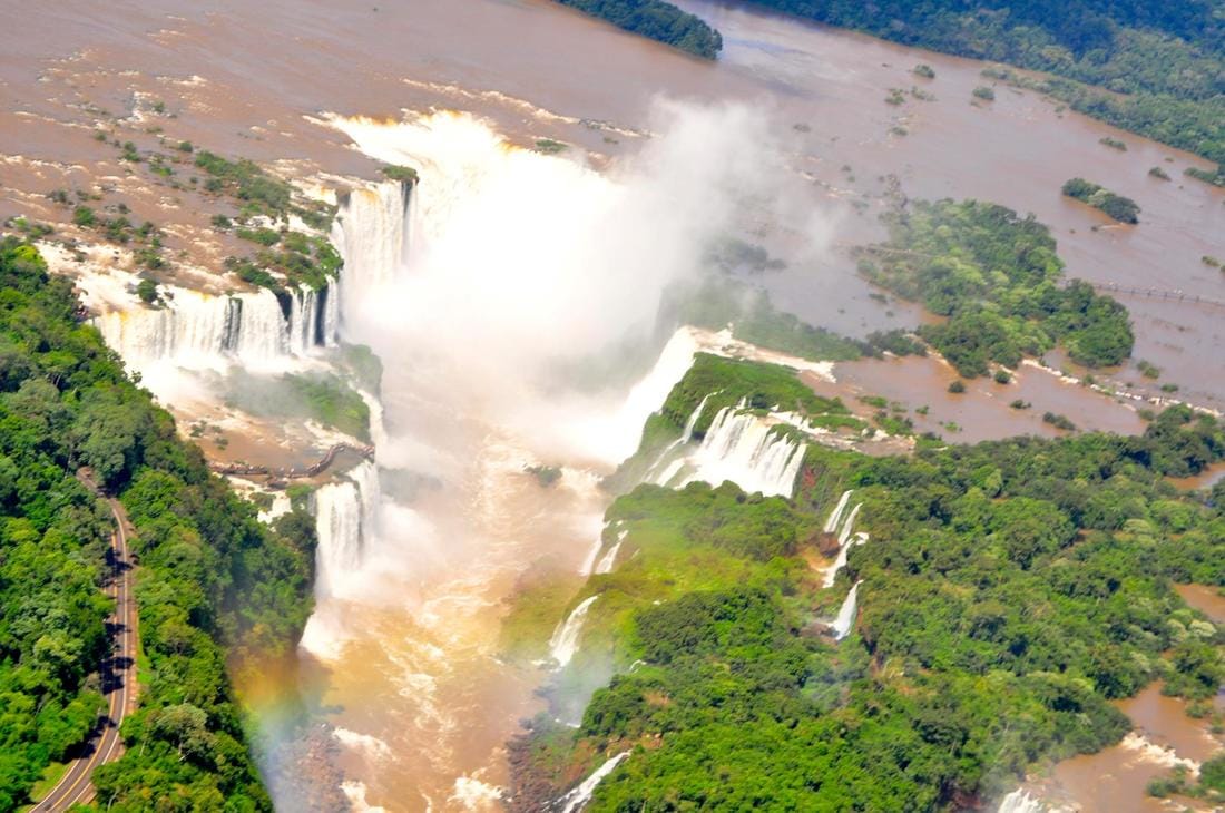 Tourism
There are two international airports close to Iguazú Falls: the Argentine Cataratas del Iguazú International Airport | IGR | and the Brazilian Foz do Iguaçu International Airport | IGU |. Argentina's airport is 25 kilometres 16 mi from the city of Iguazu, but is closer to the falls hotels than its Brazilian counterpart. There are bus and taxi services from and to the Airport-Falls. Brazil's airport is between Foz do Iguaçu, Brazil, and the falls. Aerolíneas Argentinas and LAN Airlines have direct flights from Buenos Aires to Iguazu International Airport Krause. Azul, GOL, and TAM Airlines offer services from main Brazilian cities to Foz do Iguaçu. 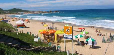 Praia Mole | Mole Beach | One of the most famous beaches is Praia Mole, close to the Lagoon of Conceição and noted for its rolling green hills and rock formations on either side. The beach is mostly known for surfing, eco-friendly lounges and LGBTQ scene during the summer. The beach is one of the locations for the ASP World Tour of the Association of Surfing Professionals, which classifies 50 competitors, among professionals and amateurs. The state of Santa Caterina is the only location in South America for this surfing event. Santa Catarina Art Museum is located in the city. 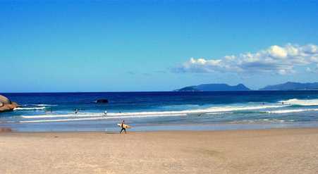 Joaquina Beach | Praia da Joaquina | Became internationally famous in the 1970s, when surfers from around the world discovered its waves. Joaquina Beach is accessible from the Lagoon of Conceição. Many surf cups began to emerge, and great Catarinense surfing personalities. It is one of the beaches that offers the best tourist facilities, receiving a large number of tourists from around Brazil and the world on the warm days in spring and summer. The rock complex situated to the left of the beach, the night lighting and the public showers are some of the trademarks at Joaquina. There is a big paid parking lot, toilets, tourist coach parking lot, lifeguards, police station, handicraft shop, bars, restaurant and hotels. In addition to the beach, it is possible to enjoy the most famous dunes in the South of the country as well as to sand board. The boards used in this sport can be rented on the spot. 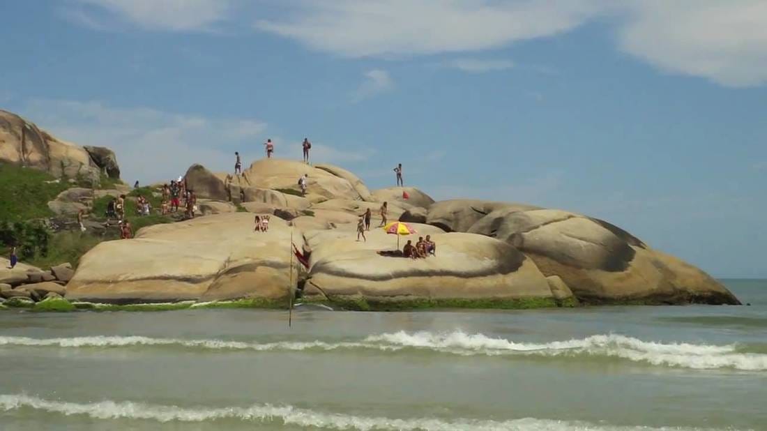 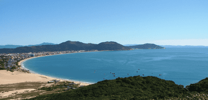 Ingleses Beach | Praia dos Ingleses | Even though it is a beach preferred by tourists, Ingleses still keeps to the traditions of the Azorian colonizers. In the summer, it is one of the top beach destinations of Argentine tourists, second only to Canasveiras. In the winter, mullet fishing, religious celebrations and regional festivities are beautiful demonstrations of the local culture. The dunes separating the Ingleses Beach | English Beach | from the Santinho Beach are natural attractions not to be missed. The practice of sand board is quite common there, a sport created in Florianópolis, which consists of sliding down the dunes on a board, engaging or not in radical manoeuvres. To practice it, one must have a lot of balance and rent a board. Those looking for a different outing can go on a trek of 4 kilometres 2.5 mi over the dunes. one of the most important archaeological sites of the State of Santa Catarina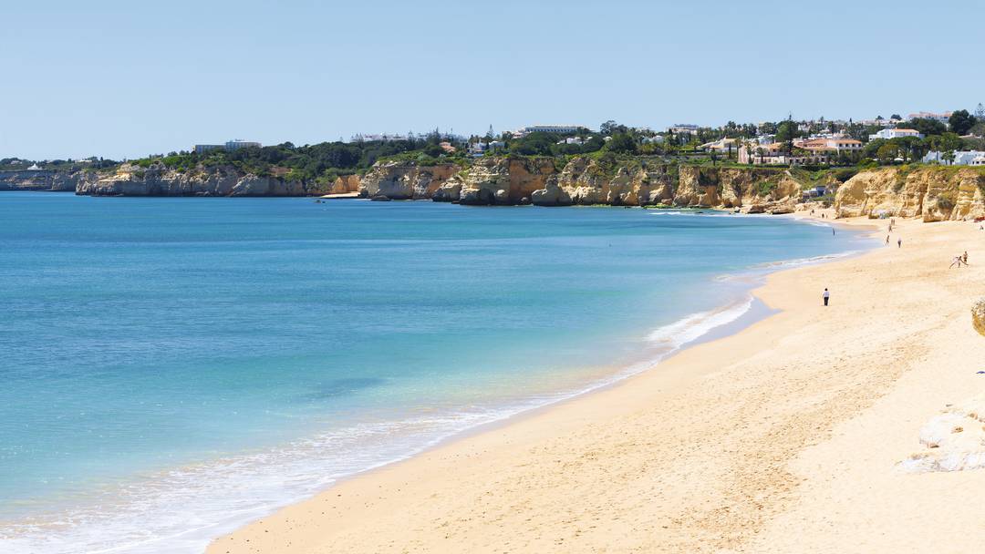 Armação Beach | Praia da Armação | The Sant'Anna Church, built by the Armação fishing company, is part of the beach's history. It was from there that whale harpooners and crewmen confessed and attended the mass before going fishing. Next, the priest would go down to the beach to bless the boats that would sail out to sea. Today, the boats leave there for Ilha do Campeche, one of the most visited islands around Florianópolis. It is also in Armação that one finds one of the most important archaeological sites of the State of Santa Catarina. In the winter of 2010 a significant portion of the beach disappeared due to erosion. With financial aid from the Brazilian federal government, tons of large rocks were dumped on the beach to prevent houses from destruction.
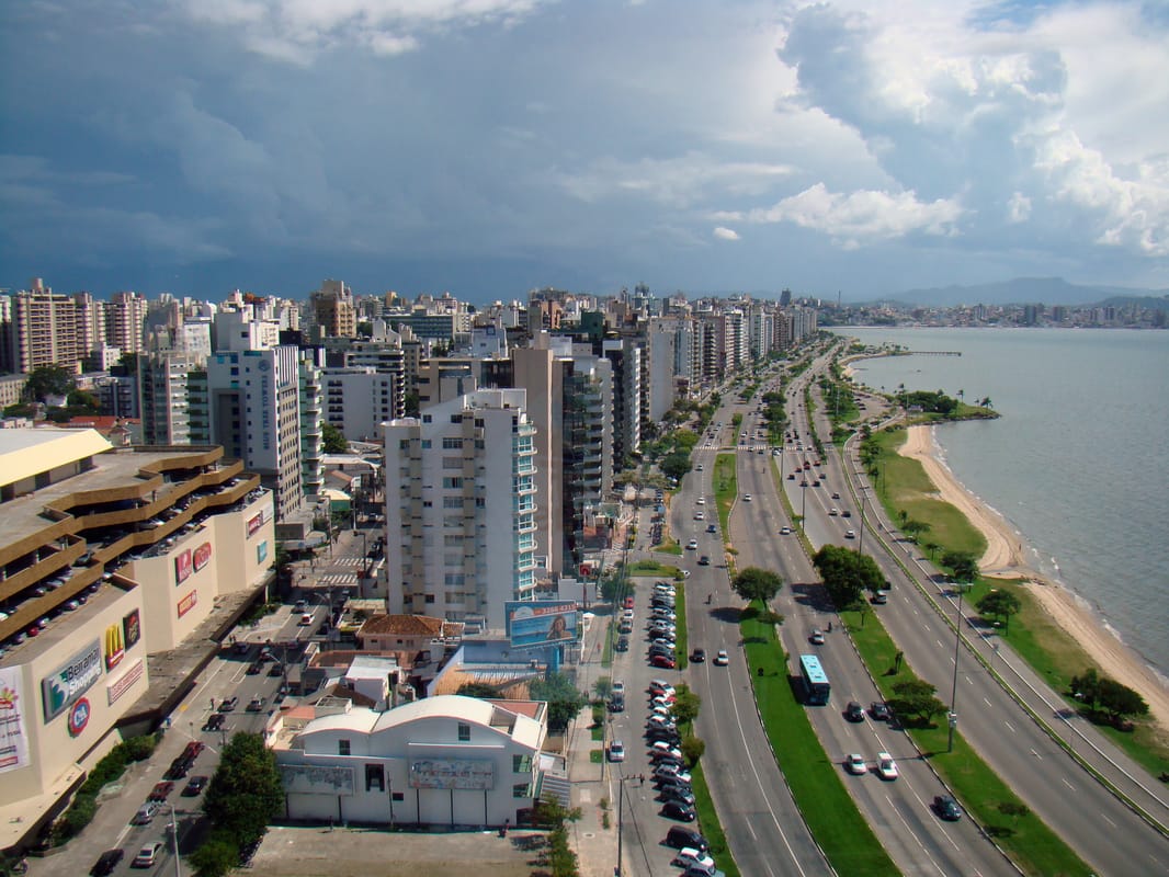 Florianópolis is the capital of Santa Catarina. The island has a population of less than 600,000 and may reach up to 2 million during summer! With 42 registered beaches, and dozens more known to locals, the city is known for having a beautiful population and being gay friendly; so don't be shy if you are LGBT, the atmosphere is inviting and people are very open-minded! 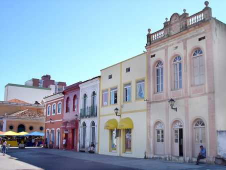 History of Florianópolis Carijós Indians, a Tupi people, were the first inhabitants of Florianópolis area. The traces of its presence are verified through archaeological sites and sambaquis dating up to 4000 years ago. The Indians called the place Meiembipe or "mountain along the channel". Around 1514 the Portuguese landed and gave the area the name Ilha dos Patos, but in 1526 it was renamed Ilha de Santa Catarina | Saint Catherine Island |. The area supplied the vessels that went to the River Plate | Río de la Plata | Basin. The official settlement of the island began in 1673 with the arrival of bandeirante Francisco Dias Velho's agricultural company and it continued in 1678 with the construction of a chapel consecrated to Nossa Senhora do Desterro. At this time a villa began to take form, slowly becoming a colonial settlement. To guarantee its domain the Portuguese Crown elevated Santa Catarina Island to the category of village in 1714 with the name of Nossa Senhora do Desterro and already in 1726 they promoted it again, now to the category of town.
From this date on Vila do Desterro and mainly the port began to have a strategic function because it was situated halfway between Rio de Janeiro and Buenos Aires, possibly two of the largest seaside cities of South America at that time. For this reason in 1739 the Capitania da Ilha de Santa Catarina was created and Desterro became its capital. Soon the most expressive seaside defensive ring of Southern Brazil started to be built: Santa Cruz, São José da Ponta Grossa, Santo Antonio and Nossa Senhora da Conceição da Barra do Sul fortresses. With the coming of the Captaincy the population began to grow, but the great population growth happened between 1747 and 1756 with the arrival of about 6,000 settlers coming from the Archipelago of Azores and from Madeira Island. The development of the agriculture, the cotton and linen industry and the commerce followed the Azorean occupation. In 1823, during the monarchy which ended in 1889, Desterro became the Capital of Santa Catarina Province opening a period of prosperity with many urban works and also intense political organization. Regional elites not happy with the government centralization staged the Revolta Federalista | Federalist Revolt | at the beginning of the Brazilian Republic. The movement that started in Rio Grande do Sul spread to Santa Catarina and turned Desterro into the Federalist Capital of the Republic. The then president of Brazil, Marechal Floriano Peixoto, known as Iron Marshal, suppressed the rebellion and ordered the shooting of many people who were considered enemies of the state, in the Anhatomirim Island Fortress. Possibly to show loyalty to the marshal, 1893 saw the change of the state capital's name: from Desterro to Florianópolis, that is to say, city of Floriano. |
